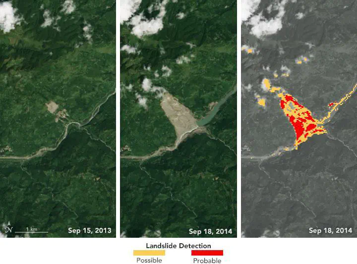
Landslide event inventories are a vital resource for landslide susceptibility and forecasting applications. However, landslide inventories can vary in accuracy, availability, and timeliness as a result of varying detection methods, reporting, and data availability.
This study used change detection algorithms in an automated software framework applied to NASA satellite data to identify areas of new bare-earth exposures that may be landslide events. The study also presents a precipitation monitoring tool that helps identify the timing of potential landslide events.